
Maps of the Current Project Area
Below are maps of the project for review from three different vantage points.
|
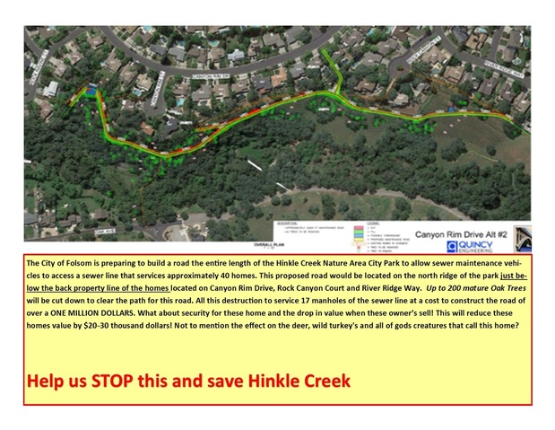
Map of the Proposed RoadThe picture to the left is diagram of the proposed road by the City of Folsom. This road would scar the pristine hillside that is home to many varieties of oak trees as well as many forms of wildlife.
This road would be cut into the very steep hillside and would be approximately a half mile long and roughly 20 feet wide. |
Google Map of the PreserveThis area not only serves as home to various forms of wildlife and foilage but was once an area inhabited by the Nisenan Maidu Indians.Grinding Rocks that they used during their time in the area are visible along the trial.
Bordering the preserve is also Lew Howard Park where numbers of families and businesses holding meetings and gatherings. |
|
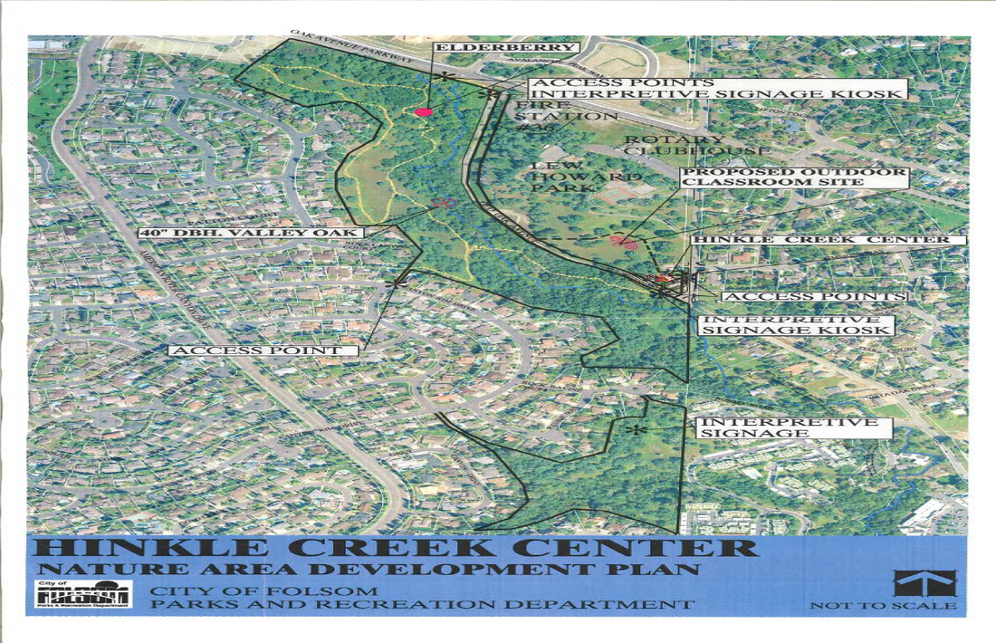
Nature Preserve Aerial ViewThis aerial view of the Nature Preserve illustrates the access points as well as the number of trees that will be removed. The removal of these trees and this deforestation will completely upset the natural balance of the area. Removing these trees and allowing for motorized vehicle access will impact the vegetation as well as the ability for the animal life in the region to survive as they have for hundreds of years dating back to the times of the Nisenan Maidu Indians.
|